PRIMERA ALERTA DEL TIEMPO: Unas fuertes tormentas son posibles esta tarde y noche
WACO, Texas (Telemundo Central Texas) - Los datos de modelos de pronóstico temprano en la mañana apuntan a una tarde y noche con tormentas en partes del centro de Texas, antes de que un frente frío avance mañana. Aunque el tiempo severo no está garantizado, existe suficiente riesgo de tormentas fuertes como para que hoy sea un día de PRIMERA ALERTA DEL TIEMPO.
Dos tipos de tormentas, pero los mismos riesgos generales
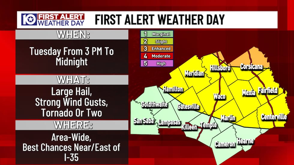
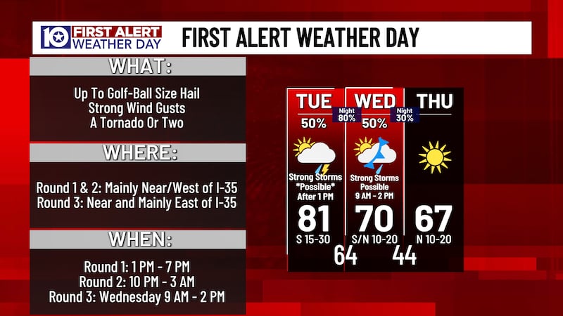
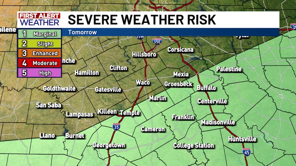
El riesgo de tiempo severo de hoy es nivel 1 o nivel 2 de 5, dependiendo de dónde viva. Las mayores probabilidades de tormentas severas están más cerca del Metroplex que de Austin; y nuestra principal preocupación serán las tormentas que se formen en el norte de Texas.
Si se forman algunas tormentas aisladas en el centro de Texas después de las 4 p.m., podrían traer granizo muy grande, fuertes ráfagas de viento y, posiblemente, uno que otro tornado aislado.
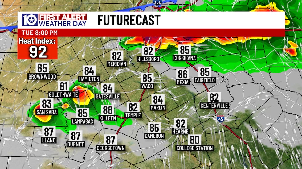
Las mejores probabilidades de tormentas llegarán con un grupo/línea de tormentas que se desplazará desde el norte de Texas cerca del atardecer y después. Estas tormentas también podrían producir granizo, ráfagas de viento y tornados, pero el riesgo se moverá más hacia ráfagas de viento después del atardecer.
Comience a monitorear las tormentas después de las 3 p.m. de hoy
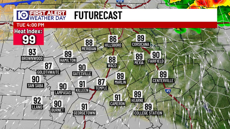
Como vimos el lunes, la atmósfera excepcionalmente cálida y húmeda podría favorecer la formación de una tormenta fuerte aislada aproximadamente entre 3 p.m. y 7 p.m. Aunque toda el área podría ver una de estas tormentas “repentinas”, es más probable que se formen (si es que lo hacen) al oeste de la I‑35. Solo hay 20% de probabilidad de que se desarrollen, pero serían impactantes si ocurren.
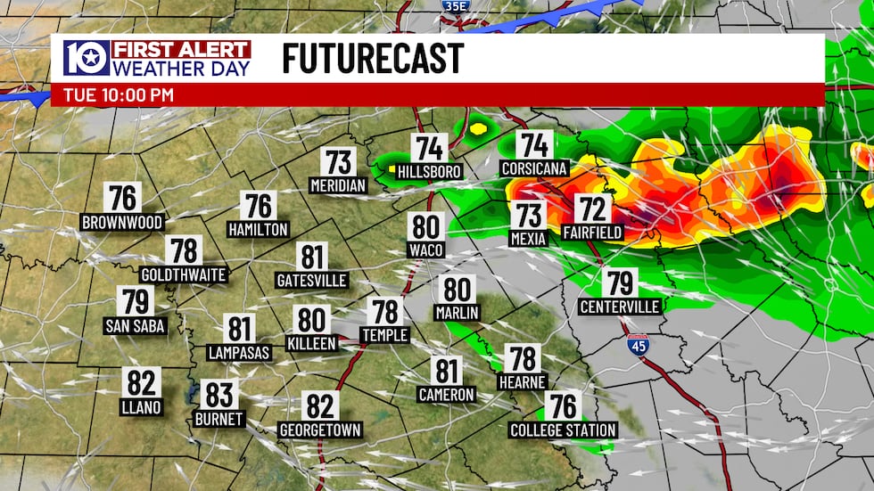
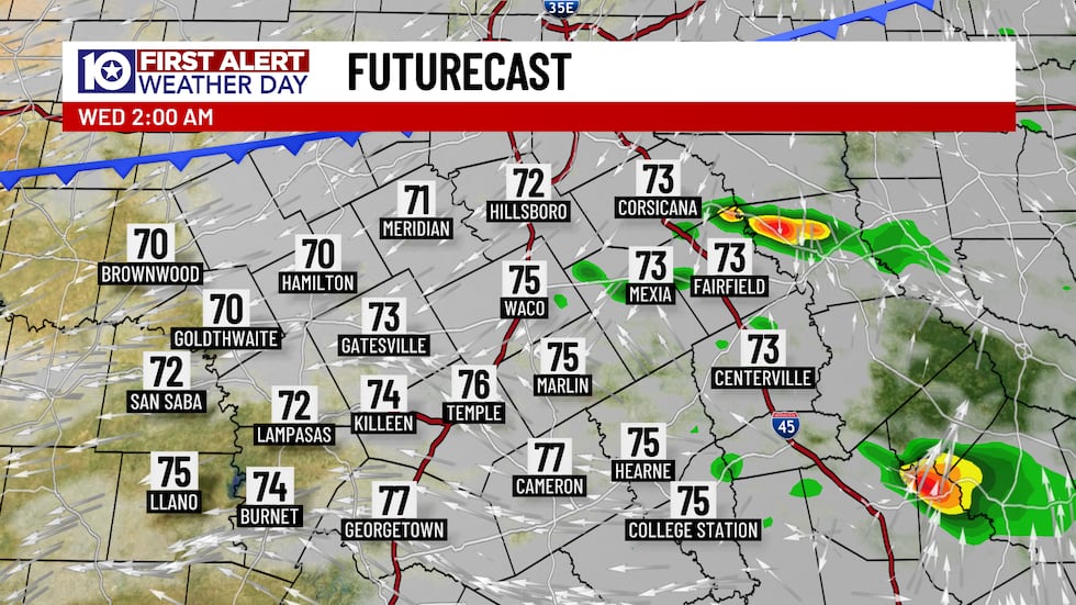
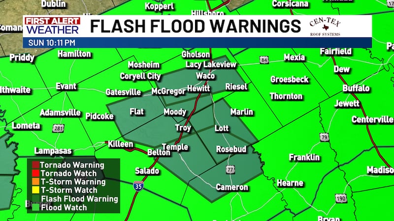
La principal oportunidad de lluvia y tormentas llega cerca del atardecer y después, desde el norte de Texas. Las tormentas se separarán del frente frío tras el atardecer, por lo que eventualmente se debilitarán, pero podría estar muy tormentoso en algunos lugares a comienzos de esta noche. Aunque toda el área podría recibir parte del grupo de tormentas nocturnas, la mayor preocupación es para las ciudades y comunidades cerca y especialmente al este de la I‑35.
El frente frío que impulsa esas tormentas se acerca mañana. Al avanzar, podría traer algunas tormentas más fuertes desde media mañana hasta primeras horas de la tarde para la mitad sur del área.
Copyright 2026 Telemundo Central Texas. Todos los derechos reservados.